SDI Standards
Why they are needed, how they are created and how to work with them
WELCOME!
With the following slides and interactive material you will be able to take part in the journey to discover Spatial Data Infrastructures (SDI) its components and benefits through the observation of multiple examples and exercises.
You can navigate through the course by pressing the navigation arrows at the bottom of each slide or using your arrow keys on your keyboard. You can move horizontally (← →) for viewing each theme and vertically (↑↓) to view extra recommended information

SDI Standards
What are standards?
Standards are…
Documented agreements containing technical specifications or other precise criteria to be used consistently as rules, guidelines, or definitions of characteristics, to ensure that materials, products, processes and services are fit for their purpose(ISO, 2019)
What are standards?
… usually in the form of documents
They are implementation neutral
E.g. Adapter for the electricity net should work for any device
E.g. Any software should be able to use or implement standards
The interesting thing about Standards is that there are so many to chose from …
Why Standards are needed?
Standardization:
- Lets stakeholders communicate and understand each other
- Makes it easier to integrate new information
- Facilitates the reuse of existing information
- Avoids errors due to misinterpretation
- Makes software development more efficient, promotes reuse of software components
- Allows communication between distributed services
Who creates standards? A high-level classification – the landscape
Basic ICT standards and other cross-discipline standards
Generic geospatial standards
Domain related geospatial standards
W3C, OASIS, IETF, IEEE,ISO/IEC JTC1, OMG, etc.
ISO/TC 211,
OGC,
but also others …
Many, like IHO, DGIWG, WMO, ICAO, but also OGC and ISO/TC 211
ISO/TC 211
38 Participating Members, 31 Observing Members
Open Geospatial consortium OGC
Not-for-profit, international voluntary consensus standards organization; leading development of geospatial standards |
 |
|
W3C Contributions
HTML
HTTP
PNG
SOAP/XMLP
SVG
URI/URL
XHTML
XLink
XML
XML Query
XML Schema
XPath
XPointer
XSL and XSLT
CSS
DOM

The standardisation process
Define requirements
Create, discuss, approve, publish (after many iterations)
Adaption by the user community
Implementation in products and processes
Monitor the impact
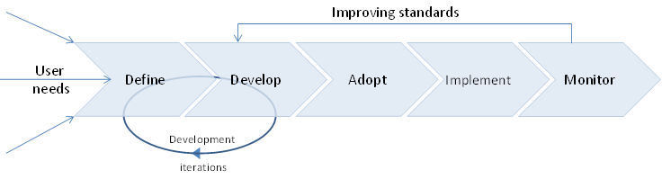
Standardisation process
Adaption is only a decision; implementation is the real uptake
Edges between the process steps are fuzzy, e.g. OGC testbeds, pilots: implement to support the development
The process is continuous:
new standards built on top of existing
standards are revised
standards become obselete
Stages of a standard during the process
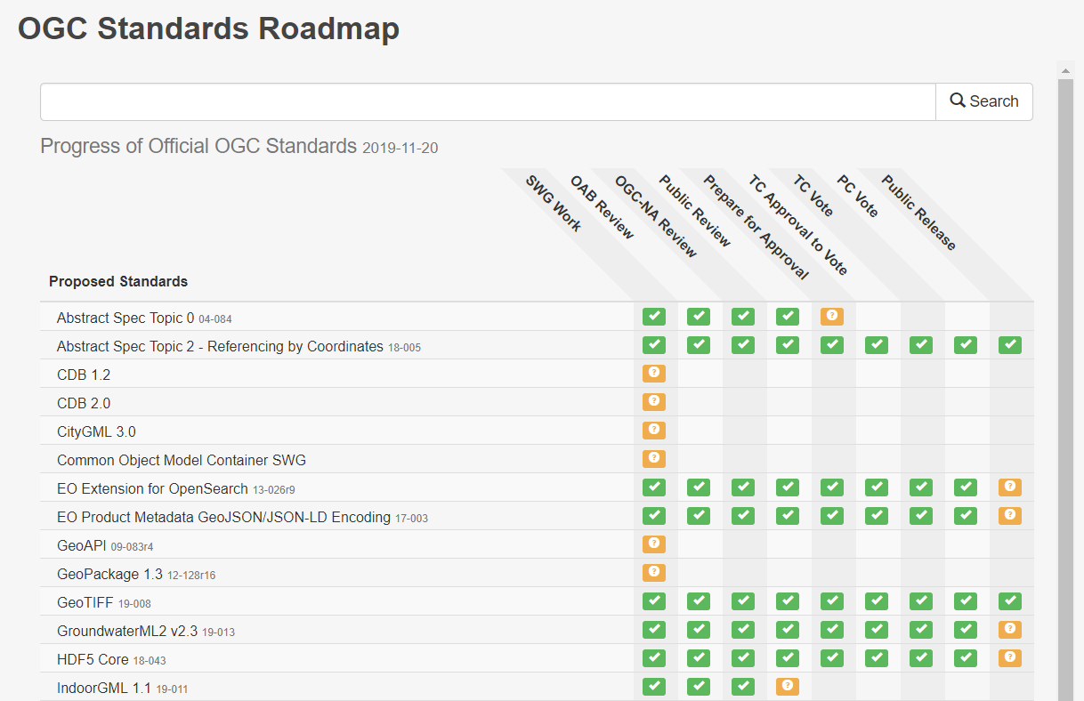
Where to find geospatial standards?
ISO
https://www.iso.org/home.html
The online browsing platform allows to previous some parts of the standard.
https://www.iso.org/obp/ui
Where to find geospatial standards?
OGC
https://www.opengeospatial.org/
Under menu standards. Not only standards, also supporting documents etc.
ISO 19100 series
Some concepts (valid for all ISO standards):
- Mandatory (M): has to be present
- Conditional (C): has to be present in certain conditions
- Optional (O): may choose to include.
ISO 19100 series
Requirements:
- Shall: it is required to; it is necessary
- Shall not: it is not allowed/permitted to, do not
Recommendation
- Should: it is recommended that
- Should not: it is not recommended that; ought not to
Permission
- May: is allowed to
- Need not: is not requited to
ISO 19100 series
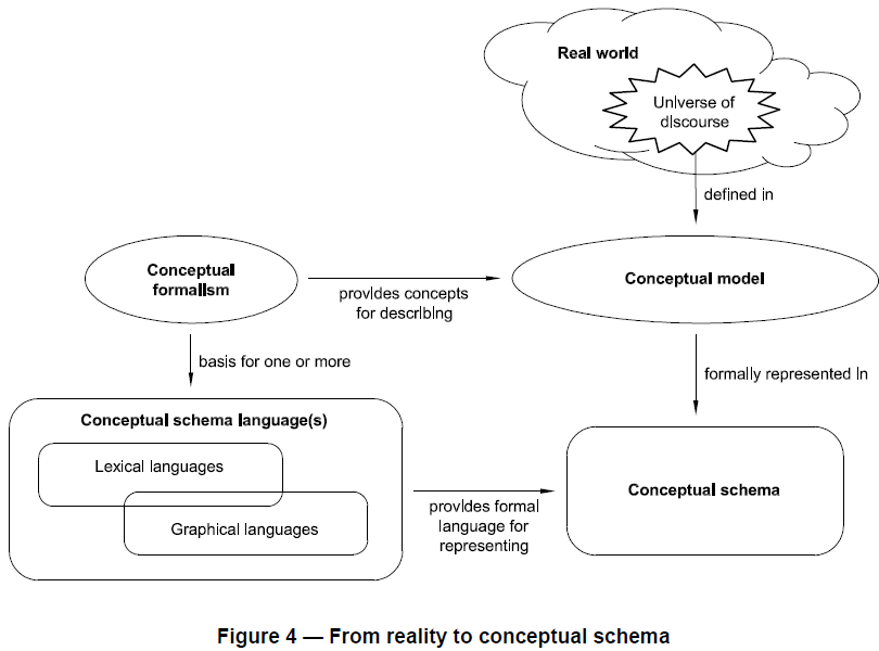
Scope of the ISO 19100 series(from ISO 19101):
The focus of this family of standards is to:
- define the basic semantics and structure of geographic information for data management and data interchange purposes
- define geographic information service components and their behavior for data processing purposes.
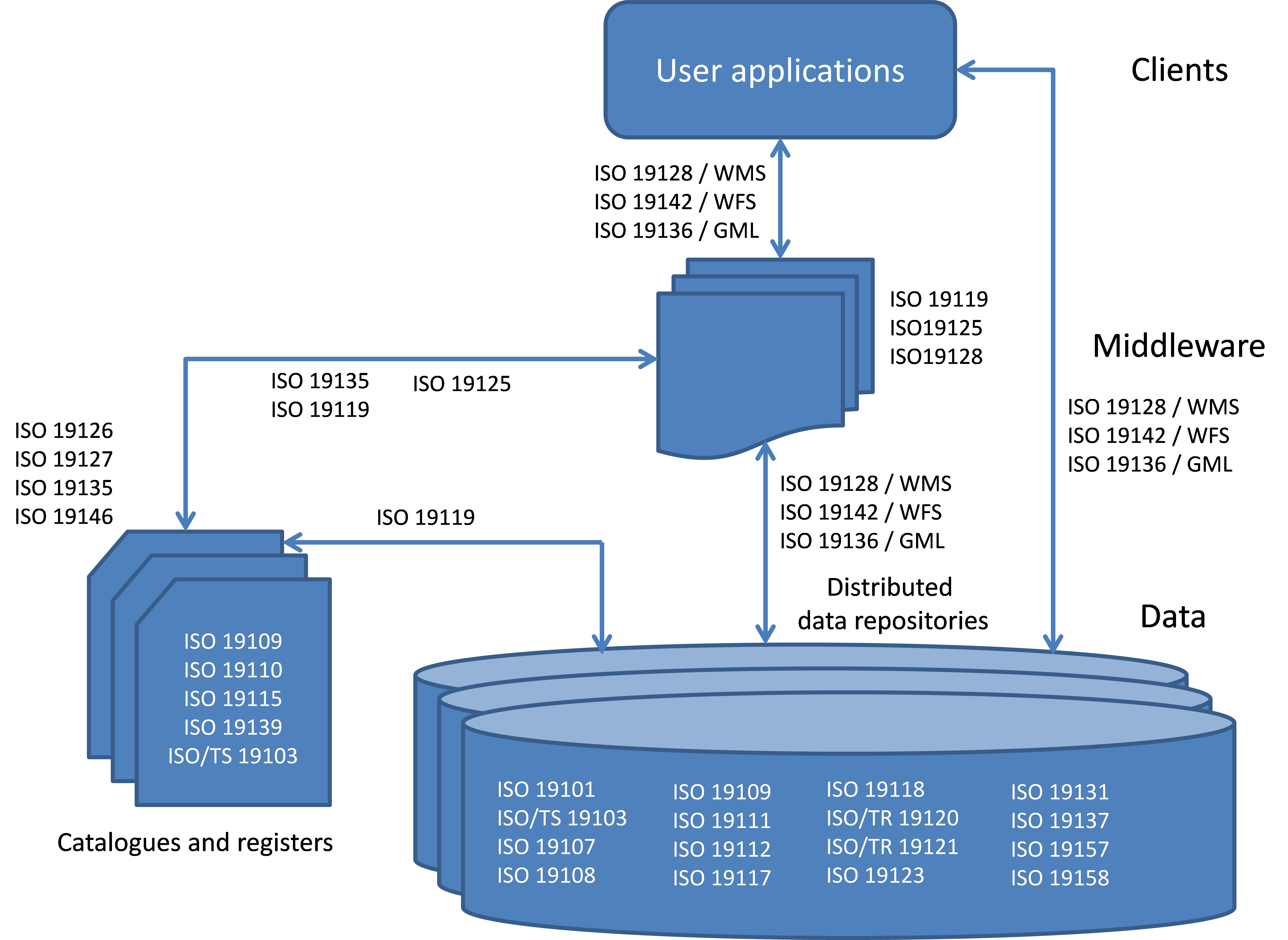
ISO 19100 Infrastructure
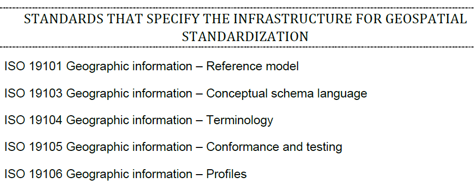
ISO 19100 – reference model
Defines the scope of work in ISO/TC211 and resulting 19000 series of standards
The reference model identifies all components involved and defines how they fit together
Integration of geographic information with information technology
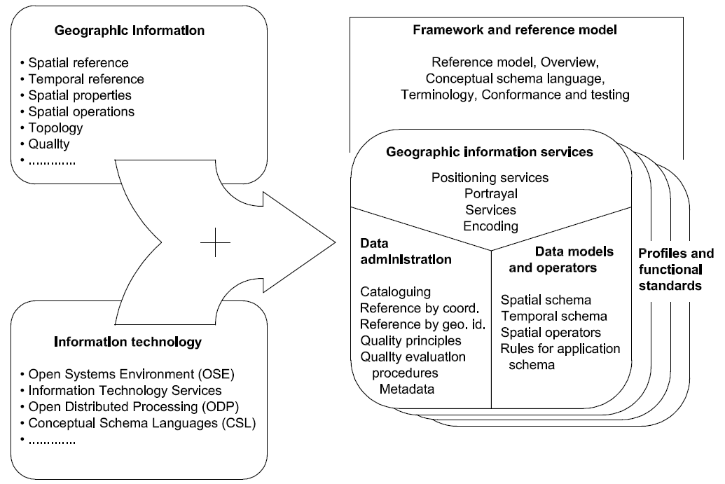
Domain reference model
How are the different items connect
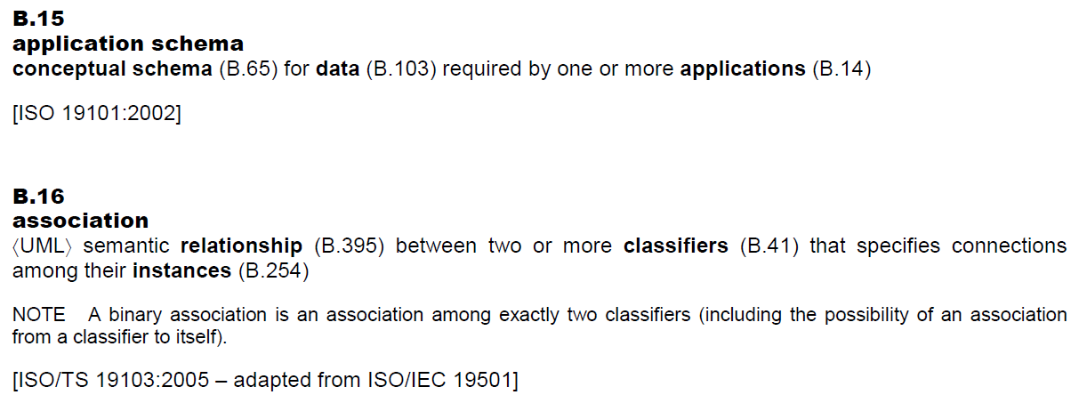
Application schema
Dataset
Feature
Spatial object
Position
Metadata
Services
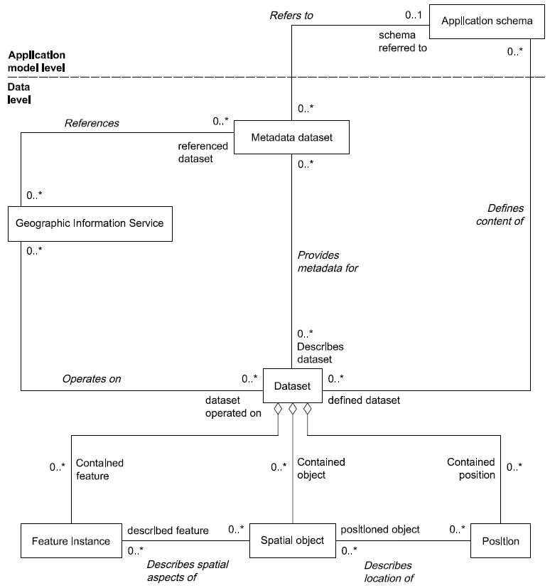
Application schema
ISO 19101 also gives conceptual model for Reference system, spatial object type etc.
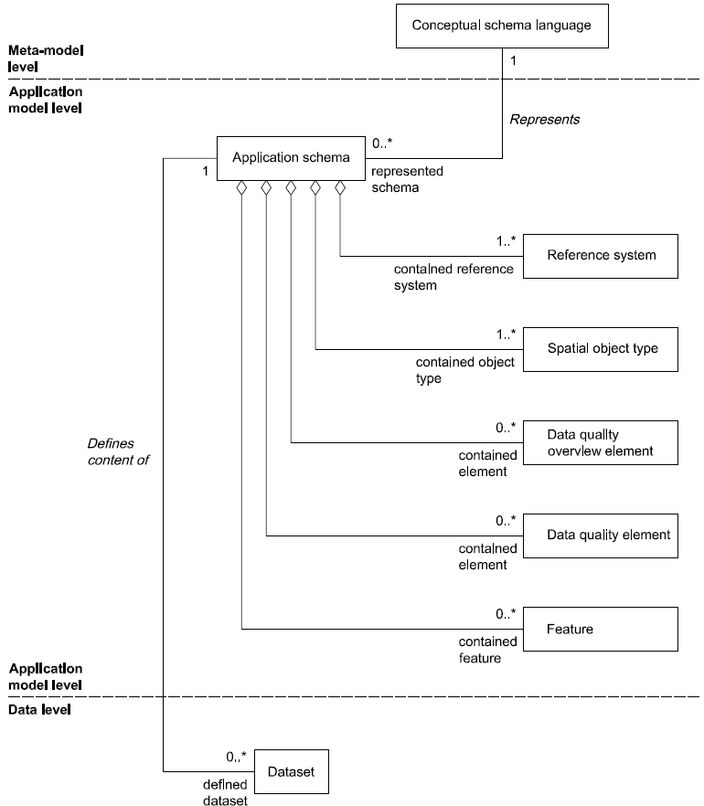
ISO 19103 conceptual schema language
ISO 19103: UML will be used as conceptual schema language
Also tells how, with which contraints etc.
ISO 19104: Terminology
Example:
19105 Conformance and testing
Conformance
What are the conditions you have to meet to comply with this standard
Testing
How can that conformance be tested
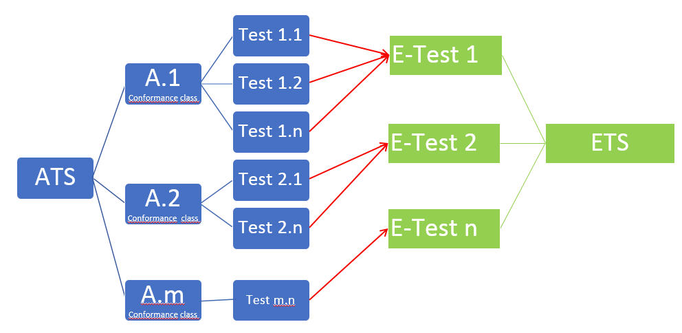
Abstract test suite (ATS):
Set of related abstract test cases specifying all the requirements to be satisfied for conformance
ATS is implemented in an Executable test suite (ETS)
19105 Conformance and testing
Every standard of the 19105 series has a conformance defined, and it contains in annex een abstract test suite for that standard.
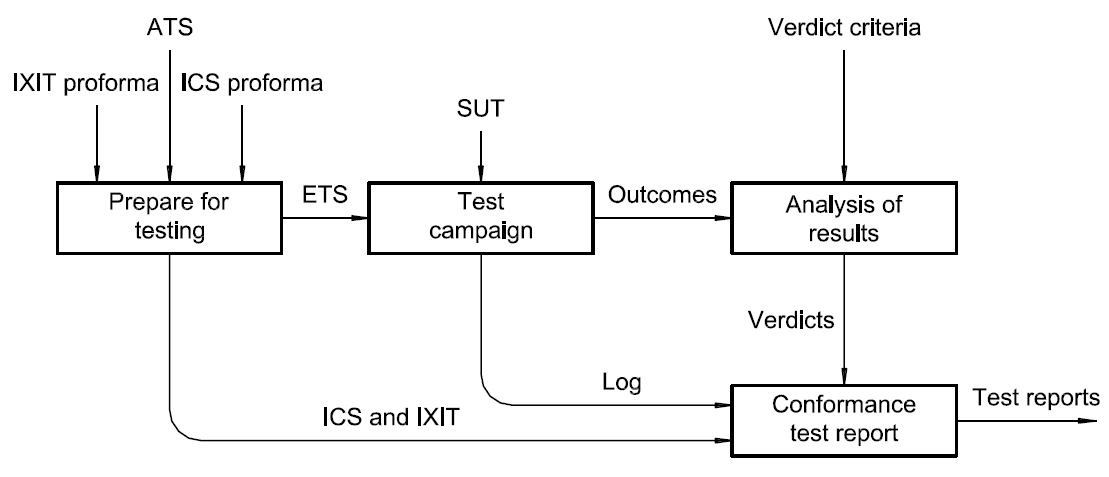
Conformity testing
Validation by testing

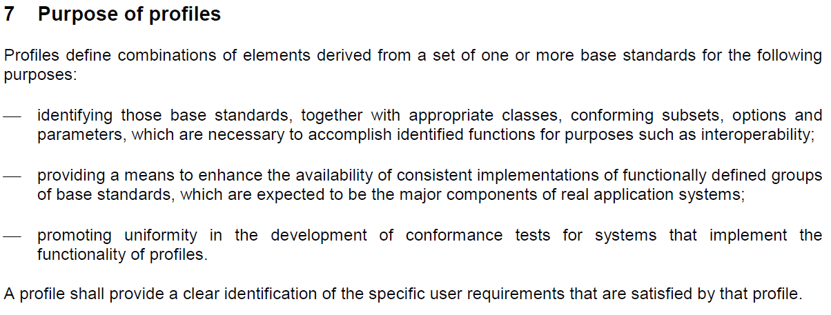
19106 Profiles
The standard itself defines a profile as:
Profile
Set of one or more base standards or subsets of base standards, and, where applicable, the identification of chosen clauses, classes, options and parameters of those base standards, that are necessary for accomplishing a particular function
Note:
A profile is derived from base standards so that by definition, conformance to a profile is conformance to the base standards from which it is derived.
By profiling standards are adapted to a specific application
19106 Profiles
2 types of profiles:
- When a profile is established as a pure subset of the ISO geographic information standards, possibly together with other ISO standards
- class 2 allows profiles to include extensions within the context permitted in the base standard and permits the profiling of non-ISO geographic information standards as parts of profiles.
19106: Why profiling?
Makes the standards “flexible”, adaptable to a requirement
Exercise
Recognize the items from the metadata infrastructure standards in any other ISO 19100 standard.
What is the scope, which other standards are normatively referenced, see how UML is used, what are the different tests in the abstract test suite
Standards for Data

Data standards
Data should be standardized according to an agreed data model (schema)
Series of interconnected standards:
ISO 19101 – Reference model
ISO/TS 19103 - Conceptual schema language
ISO 19107 – Spatial schema
ISO 19108 – Temporal schema
ISO 19109 – Rules for application schema
ISO 19110 - Feature cataloguing methodology
ISO 19117 - Portrayal
ISO 19118 – Encoding
ISO 19157 - Quality


Data standards
DATA SPECIFICATION
II
Synonym to data product specification
Detailed description of a data set or data set series together with additional information that will enable it to be created, supplied to and used by another party
[ISO 19131]

Example product specs:
ISO 19152: 2012 - LADM
ISO 19160-1/6: 2009 - Addressing

From specification to application
Relevant:
ISO 19107
ISO 19108
ISO 19109
Data standards
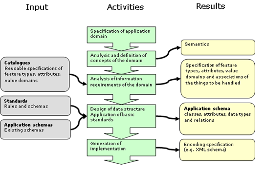
Application schema
Defines the model
Data harmonization
Getting your data in the reference (standard) model
Data transformations might be necessary (ETL)
SDI and Geospatial Standards
OGC
36 core implementation standards
21 abstract specifications
ISO/TC 211
51 international standards and technical specifications
CEN/TC 287
adopted more than 40 ISO standards
(Figures 2015)
Standards for services
But also additional OGC standards
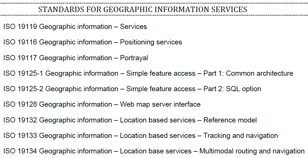
Service standards
Service-oriented architecture (SOA)
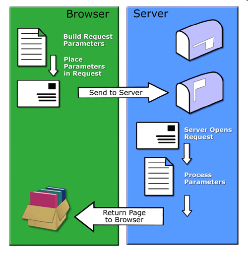
Remote procedure calls (RPC)
A Client sends a request message to a known remote server to execute a specified procedure with supplied parameters
The remote server sends a response to the client

OGC:
CSW - Catalogues
WMS, WMTS - Maps
WFS, WCS - Download
WPS – Processing
SOS, SPS - Sensors
Standards for metadata
ISO 19119 sets the metadata elements for services
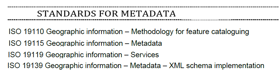
Metadata standards
Relevant standards:
ISO 19115: 2003
ISO 19139: 2007 (encoding)
ISO 19115-1: 2014 (fundamentals)
ISO 19115-2: 2019 (extension)
ISO 19115-3: 2016 (XML)


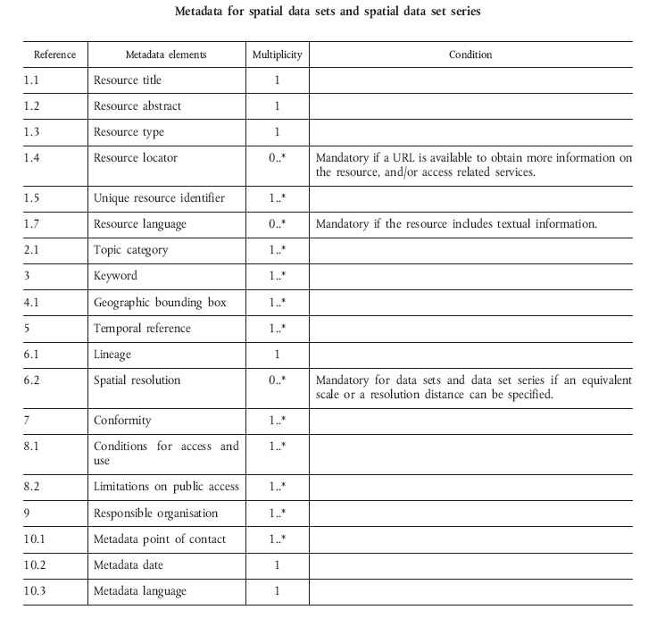
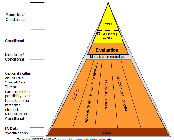
Metadata elements:
Some are mandatory
Multiplicity
Some use code lists
Note 1:
Metadata standard is enforced by a tool:
Separate editor or within a GIS
Note 2:
Other metadata standards exist:
Dublin Core
DCAT, DCAT-AP and GeoDCAT-AP
Metadata standards
Where to find standards
ISO
https://www.iso.org/home.html
The online browing platform allows to previous some parts of the standard.
https://www.iso.org/obp/ui
OGC
https://www.opengeospatial.org/
under menu standards. Not only standards, also supporting documents etc.
W3C (not geospatial, but XML etc)
https://www.w3.org/standards/


Additional documentation
Standards guide by ISO/TC 211
https://trac.osgeo.org/geonetwork/raw-attachment/ticket/189/ISO%20TC%20211%20-%20Standards%20Guide.pdfISO online browsing platform
https://www.iso.org/obp/uiISO document on how to write standards (can be useful when reading them)
https://www.iso.org/files/live/sites/isoorg/files/archive/pdf/en/how-to-write-standards.pdfOGC Guide to the role of Geospatial standards
https://www.opengeospatial.org/unggimReference list
- Bartha, G., & Kocsis, S. (2011). Standardization of geographic data: The european inspire directive. European Journal of Geography, 2(2), 79-89.
- Ma, X. (2017). Linked Geoscience Data in practice: Where W3C standards meet domain knowledge, data visualization and OGC standards. Earth Science Informatics, 10(4), 429–441. https://doi.org/10.1007/s12145-017-0304-8
- Nativi, S. (2010). The implementation of international geospatial standards for earth and space sciences. International Journal of Digital Earth, 3(sup1), 2–13. https://doi.org/10.1080/17538941003764412